I almost gave up, but oh, what a hike. 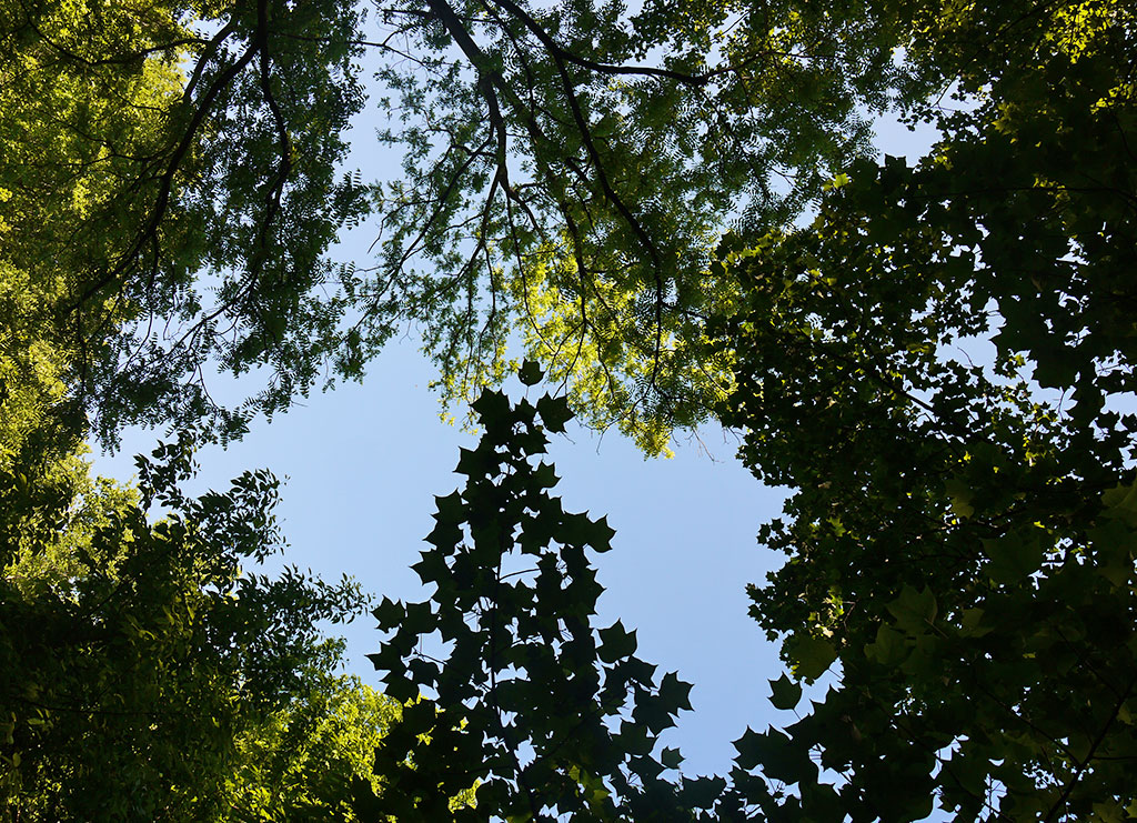
It’s tricky to plan an itinerary for national parks, at least for us. For one, we had no idea what to expect and it depends on the transportation. In the case of our trip to the Great Smoky Mountains National Park, I was a bit too enthusiastic and wrote down the four to five major attractions. And when we went the visitor center and showed the map to the volunteer, she pointed to the places and said, “well, honey, you won’t be able to do all of this today!” Woops.
So we made some quick decisions: one waterfall, quick lunch and then Clingman’s Dome. (If you have more time, throw in the Cades Cope Loop Road, which was a very popular destination but would have cost us four to five hours in the car just to get there.)
등산이나 캠핑을 즐기지 않은 우리에게 국립공원은 그렇게 매력적인 장소는 분명 아니었다. 하지만 미국에 있는 동안 제대로된 국립공원 구경을 해야하지 않겠냐며 당당하게 계획을 세운 곳이 스모키 마운틴 국립공원. 테네시에 위치하고 있고 우리가 사는 디트로이트에서 차로 8시간 정도. 가장 먼저 챙긴건 멀미에 좋다는 생강. 마트에서 파는 설탕에 조린 생강이긴 했지만 그럼에도 불구, 이렇게 많은 생강을 먹은 건 처음.
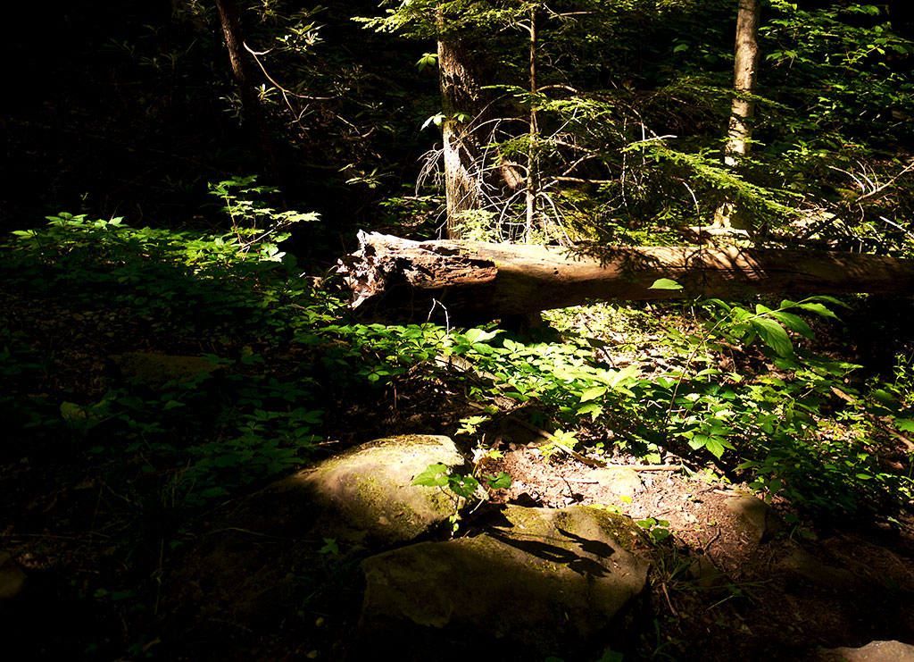
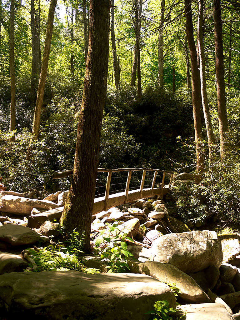
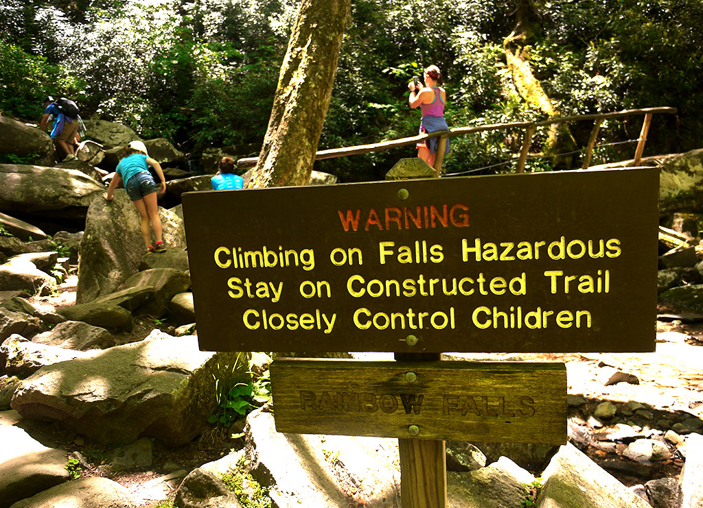
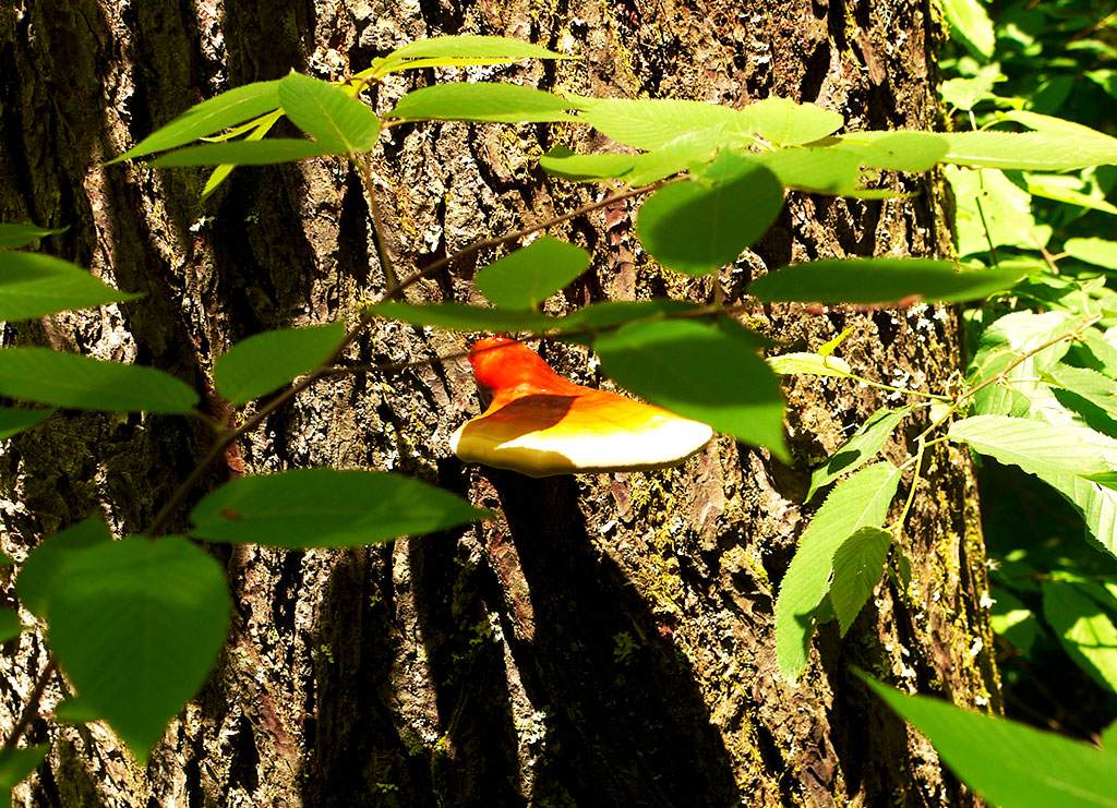
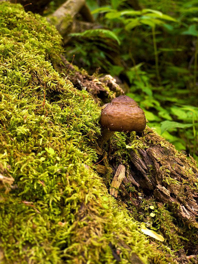
We chose the Rainbow Falls because, well, it was on the way to Clingman’s Dome and also because was the highest. (Which we didn’t really think through) One thing that was very frustrating was that there are no signs that show you how far up or down you are. Yes, you can get those little personal gadgets that tell you “Four miles,” but for those who don’t need them, it could have been helpful to see some sort of sign. It did seem that everyone was having the same issue, because we were all asking one another “how long do we have left? Are we there yet? Are we close?”
워낙 드넓은 공원이라 모든 폭포와 등산로를 섭렵할 수는 없어서 일단 무지개 폭포 그리고 공원에서 가장 높은 전망대인 Clingman’s Dome을 선택. 무지개 폭포는 전망대 가는 길에 있어서 선택했지만 다시 선택할 수 있었다면 조금 덜 험한 다른 곳을 택했을지도. 무엇보다도 힘들었던 점은 등산로에 표지판이나 표시가 하나도 없었다는 것. 한시간 정도 오르고 나니까 주변 모든 사람들이 서로 끝까지 얼마나 남았냐고 물어보는 상황. 왕복 4시간이 걸렸다.
여기서 궁금했던 부분. 얼마나 남았냐고 물어봤다면 상대방이 많이 남았으면 “아, 아직 좀 멀었어요”라고 솔직하게 말해주는게 좋은지, 많이 남았어도 “좀만 더 가면 되요, 금방 다 가요”라고 희망적인 메시지를 해주는게 좋은지. 난 개인적으로 솔직하게 말해주는게 좋은듯. 희망이고 뭐고, 정확한 상황을 판단하고 싶은 마음.
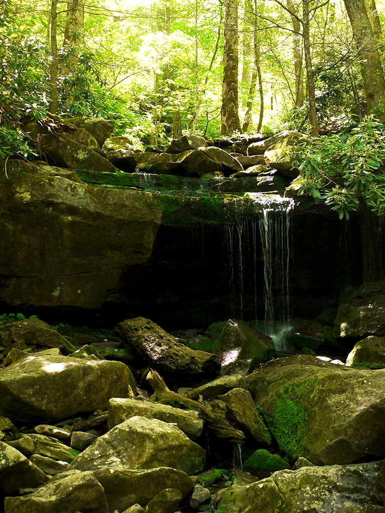
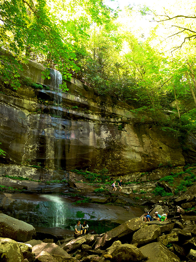
The final destination is indeed very rewarding. (But for me, it didn’t go so long because it took three minutes per rock for me to jump on to. )
폭포 도착! 20분 정도 쉰 후 다시 내려가기 시작. 내려오는 길에 발목 삐끗. 힘들다고 너무 불평해서 산이 벌을 준 모양.
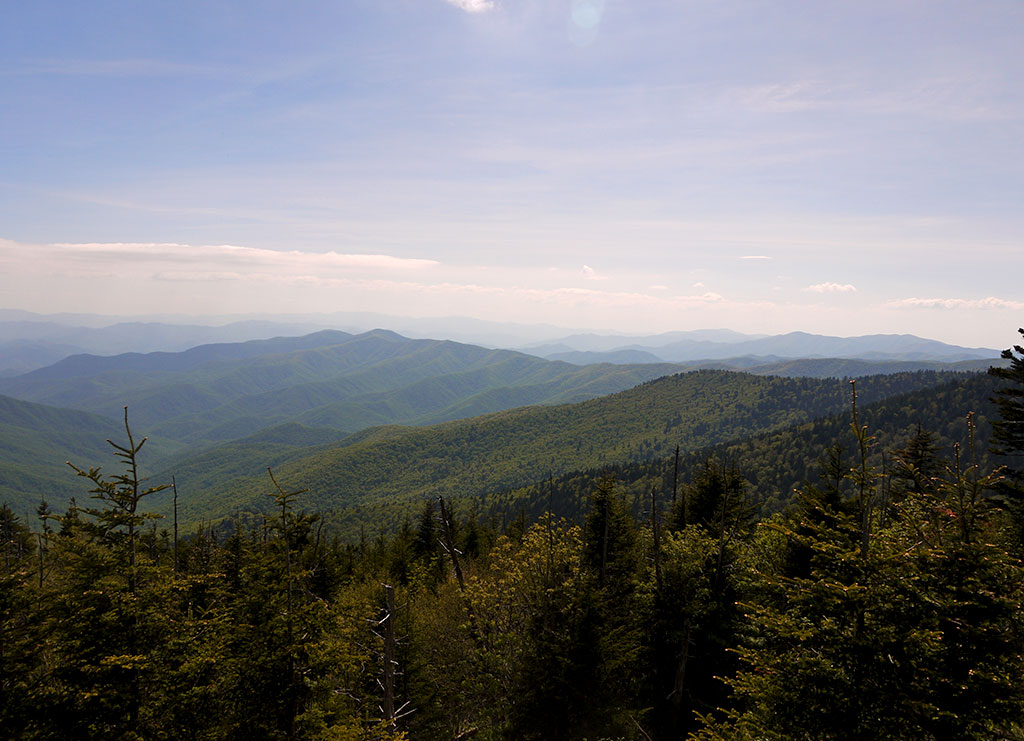
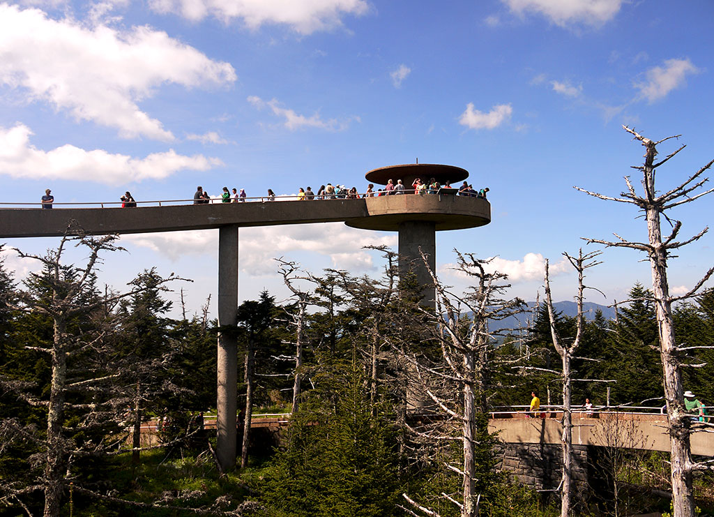
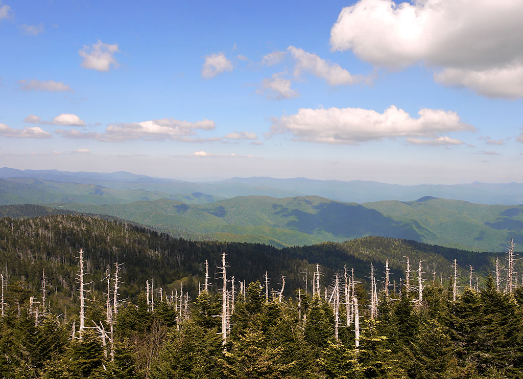
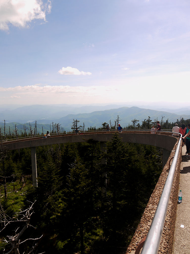
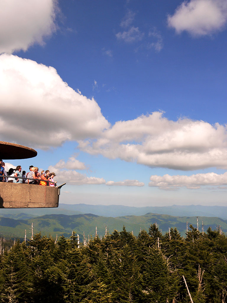
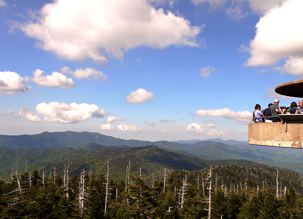
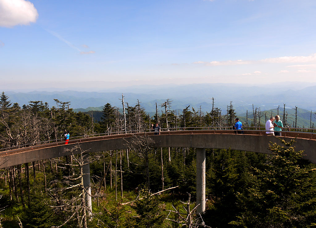
Clingman’s Dome is the name of the mountain and is the highest in the Smokies, highest point in the state of Tennessee and the highest point along the Appalachian Trail. The road to it and the observation tower can be a dizzy one, not only because the narrow roads are very zigzaggy, but also because there are a lot of people, cars and motorbikes stopping here and there to take photos. It reminded me of Scotland, but with more cars and much more motorbikes and thus seemed a bit more dangerous, so watch out when you stop. Even without the photo stops, the road is narrow and dizzy, so be prepared or nibble on some candied ginger.
클링맨스 돔은 국립공원에서 가장 높은 산으로 테네시주에서도 가장 높은 곳이다. 가는 길이 꼬불꼬불해서 멀미가 나기 굉장히 쉬운 곳. 스코틀랜드에서도 그랬지만 가는 길 중간 중간에 주차공간이 있어서 사람들은 운전을 하고 가다가 멈춰서서 사진을 찍는다. 스코틀랜드에는 사람들이 많지 않고 차도 많지 않아서 못 느꼈는데 좁고 경사가 높은 길을 가다가 중간 중간에 이런 곳이 있어서 굉장히 위험한 느낌. 멀미를 잘하는 나는 특히 이 구간에서 생강 사탕을 계속 입에 물고 있었다는 사실.
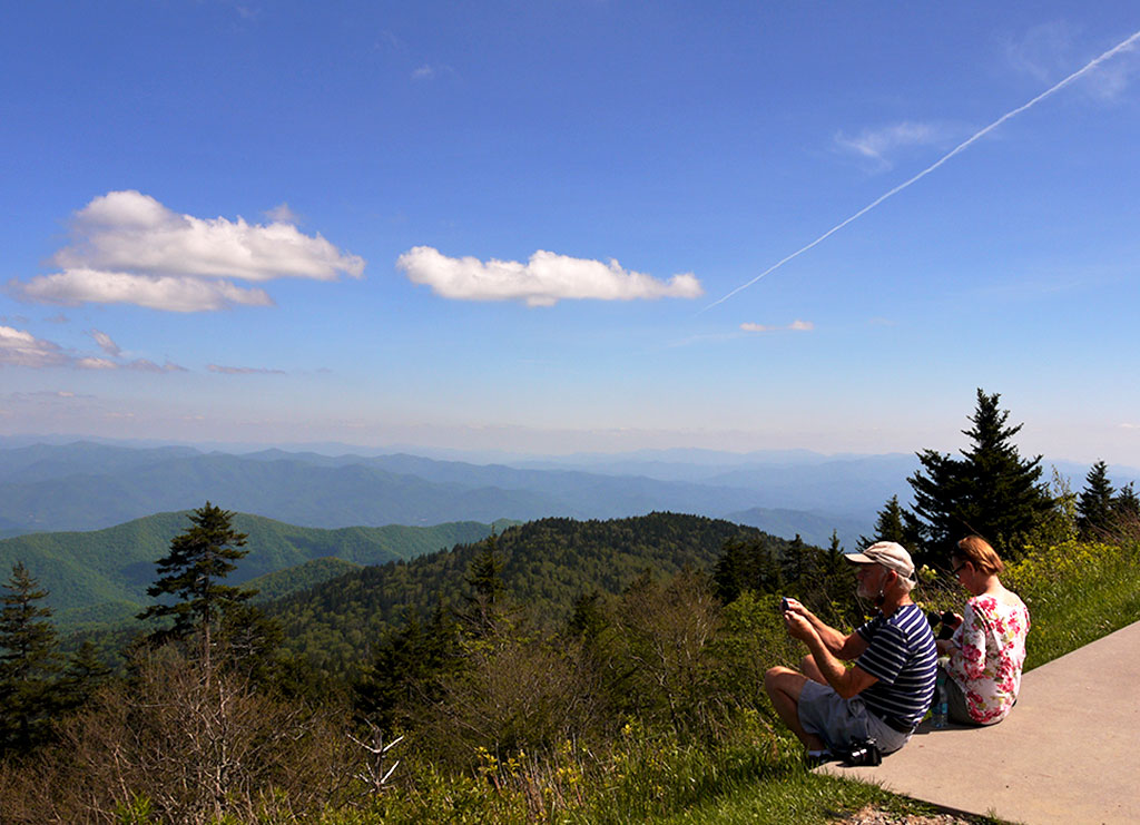
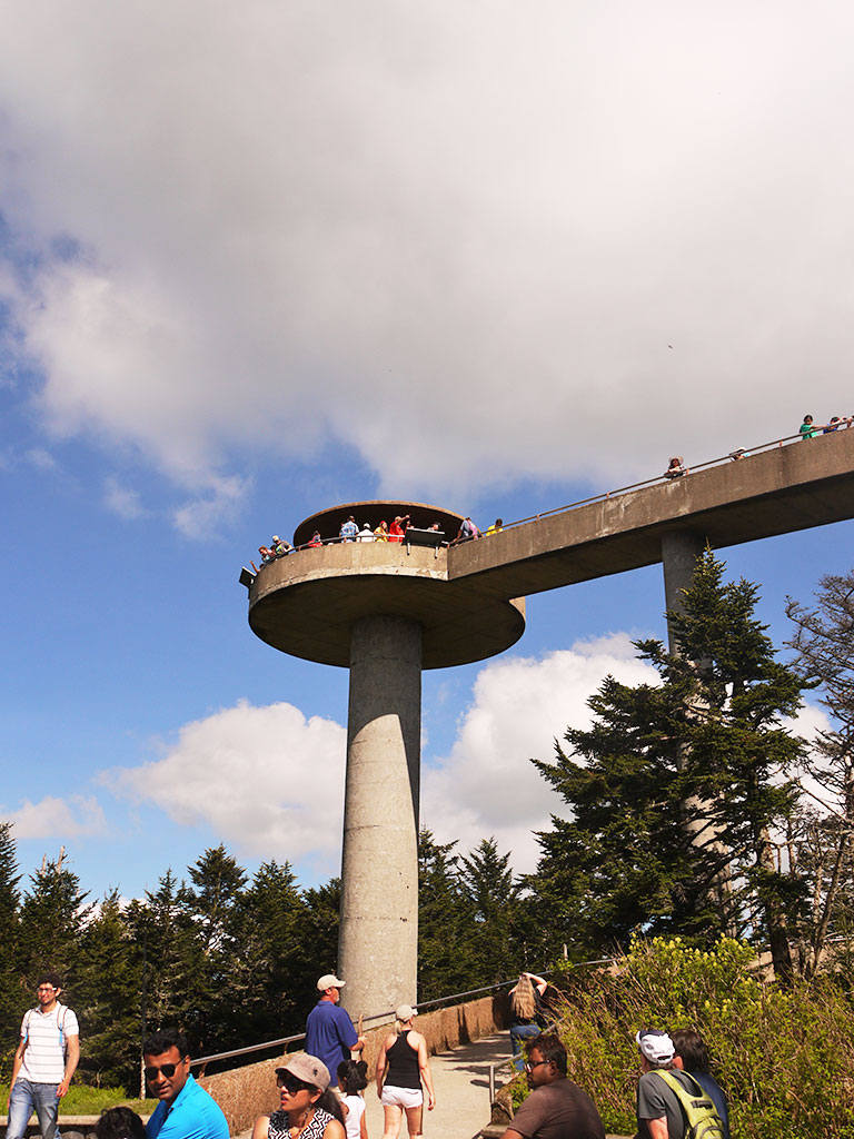
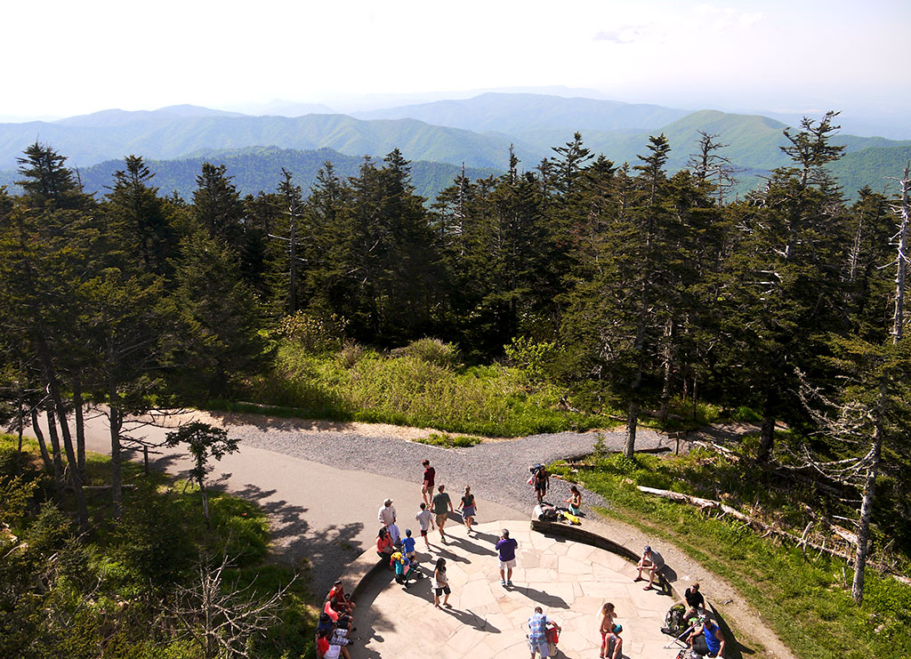
You still have to walk up a quite steep half mile to get to the tower. (Again, a lot of “are we there yet?” but there are a lot of benches so thank god for those.) The tower was built in 1959, is 14 meters high and is surprisingly modern for its time. In fact, some criticized the tower for being too “urban,” but it looks and feels quite arty now. Even a bit Men in Black-ish. Plus, if there were stairs, I really don’t know if I would have gone all the way up. Because by the time you are actually in front of the dome, your legs feel very jello-y.
이렇게 UFO같은 전망대라니. 주차장에 주차를 하고 나서도 여기까지 올라오려면 굉장히 경사가 심한 길을 30분 정도 올라가야하는데 여기서도 다시 한번 모든 사람들이 “얼마나 남았어요?” “조금만 더 가면 되요” “거의 다 왔어요” 등등의 대화를 나누기 시작. 최근에 지어진 전망대라고 생각했는데 1959년에 지어졌다. 당시에 너무 지나치게 세련된 느낌이라 비판 받았다는데 지금 보면 뭔가 영화 맨인블랙에 나올법한 디자인.
 If you are going to hike or hike up to see the waterfalls, check the difficulty and the time that will be spent. You can find information here.
- I don’t know why and how this was, but there were so many people walking around with flip flops, even on hiking trails. WHY and NO.
- Water. More water. And more.
- If you see a bear. Because you never know.
- If you get carsick really easily, take some candied ginger. Lifesavers.

 Take your time when pre-planning a trip to national parks. One day can be a bit tight, two or three can be too much, so it really depends on what you’re looking for.
- Don’t feel pressured to stay too near the national park, for instance Gatlinburg. The town is fun and very touristic, but very crowded and a bit too much, in my opinion. We stayed at an Airbnb in Sevierville and it was close to the entrance, around 25 minutes, and so much cheaper and a bit more quieter. (Another good possibility is Pigeon Forge.)

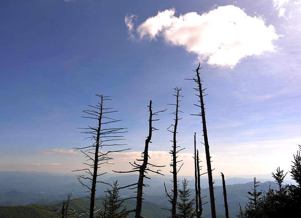
All photos by rachelsanghee. May, 2015.
Looks like it was a beautiful hike! The waterfalls are gorgeous!
It was quite a view 😀